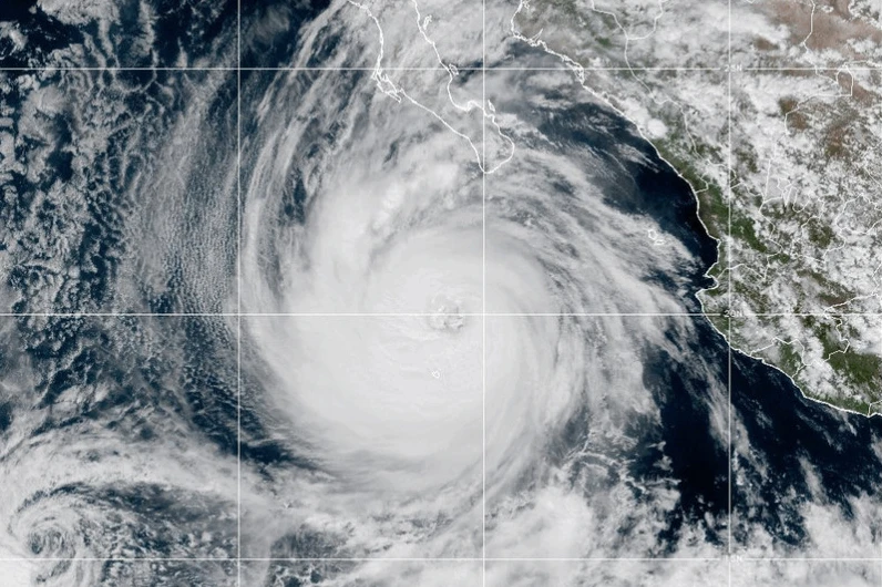
MIAMI (AP) — Hurricane Priscilla has weakened as it progresses along the west coast of Mexico, while Tropical Storm Jerry is expected to strengthen on its path toward the Leeward Islands, according to forecasters.
Initially nearing major hurricane status, Priscilla is now a Category 1 storm, with maximum sustained winds dropping to around 80 mph (129 kph). Heavy rainfall and flash flooding are still possible, especially as it moves northwest along Mexico's Pacific coast this week.
As of Wednesday morning, Priscilla was centered approximately 195 miles (314 kilometers) southwest of Baja California's southern tip and moving northwest at 8 mph (13 kph).
Meanwhile, in the Atlantic, Tropical Storm Jerry is packing winds of 50 mph (80 kph) and is centered about 835 miles (1,344 kilometers) east-southeast of the northern Leeward Islands, advancing west-northwest at 23 mph (37 kph).
Jerry is predicted to strengthen into a hurricane by Thursday, potentially impacting the northern Leeward Islands with significant rainfall between 2 to 4 inches (5 to 10 centimeters) from late Thursday into early Friday.
Tropical storm watches are currently in place for several islands in the region including Antigua, Barbuda, and St. Kitts, Nevis, and Montserrat. The watch for Hurricane Priscilla extends to Baja California Sur, particularly from Cabo San Lucas to Cabo San Lazaro.
Priscilla continues to affect coastal areas of southwestern Mexico with large waves, although it's expected to weaken further.
In another part of the Pacific, Tropical Storm Octave is also weakening as it moves eastwards without threatening land, indicating the overall shifting dynamics of these weather patterns.