A new map has unmasked the landscape beneath Antarctica's ice in unprecedented detail, enhancing our understanding of the frozen continent.
Researchers employed satellite data alongside the physics of glacier movement to uncover Antarctica’s hidden geography.
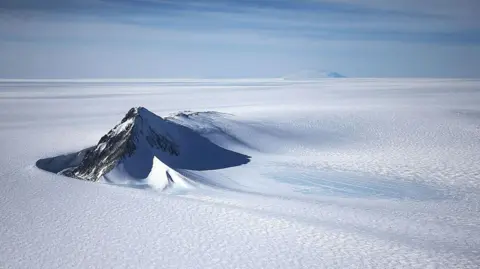
The mapping reveals thousands of previously undocumented hills and ridges, providing clearer images of Antarctica's concealed mountain ranges.
Despite some uncertainties, scientists believe this enhanced understanding could inform predictions about how the continent will respond to climate change, particularly concerning sea-level rise.
Lead author Dr. Helen Ockenden states, It's like before you had a grainy pixel film camera, and now you've got a properly zoomed-in digital image of what's really going on. This revelation comes at a critical time, as understanding Antarctica's melting glaciers is considered one of the biggest unknowns in climate science.
Previous ground-based measurements had offered limited perspectives, often relying on radar along sparsely spaced survey lines. In contrast, this new approach combines satellite imagery with an understanding of ice flow, resulting in the most detailed map of Antarctica's bedrock to date.
The research reveals features like deep channels within the ice, which could influence how glaciers move and ultimately impact global sea levels. Dr. Robert Bingham, a co-author, expressed excitement over the findings, declaring it amazing to view such a comprehensive depiction of Antarctica's underbelly.
As the scientific community continues to explore the complexities of this icy realm, the new map stands as a vital tool for future research on climate impacts, underscoring the urgent need for ongoing studies in the context of warming temperatures globally.